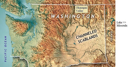
A Randall Carlson video showed last year or earlier that the Washington Scablands were flooded not just from the Lake Missoula, Montana direction, but also from the direction of Canada. This PBS video supports that claim. Below is a transcript of the video starting at the 6 minute mark. That flood and several others likely occurred during or near the time of the Younger Dryas impacts. I may combine this post with COLUMBIA RIVER BASALT GROUP.
Video title: “Earth’s History Is Hidden in These Strange Maps”
6'13"
Dry Falls {near Coulee City, WA} is a staggering geological wonder, a remnant of an ancient waterfall that was five times wider and over two times the height of Niagara Falls.
By adding Lidar data, we can uncover details in the massive Dry Falls cliff face.
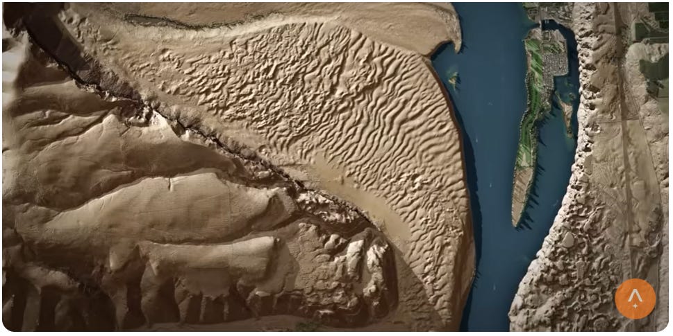
These huge ripple marks along the Columbia River near Trinidad, Washington, reveal the impact of enormous amounts of water rushing over the surface,
and these tiny streams hide a far more dramatic story.
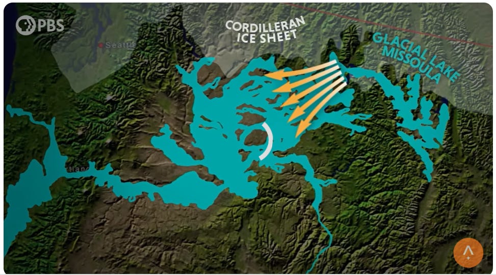
Since Bretz's first hypothesis, these ancient flood waters flowing from Montana, mainly glacial Lake Missoula, were believed to be solely responsible for carving the scablands.
But Lidar's powerful ability to see through hidden terrain is uncovering a new twist to that story. “It's always exciting to find a new dramatic feature on the landscape that has been there the whole time, sort of hiding in plain sight.
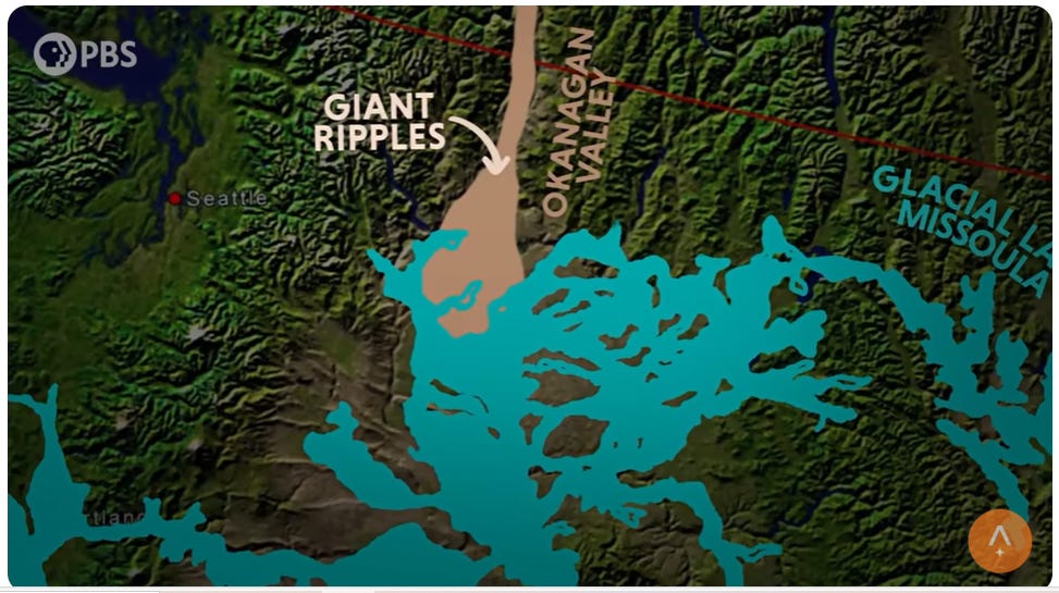
Geologist Skye Cooley was looking at some lidar in the area near Omak and found these giant current ripples.
Those were interesting because they're in the Okanagan Valley. Prior to Lidar, we were not aware that there were major floods that came down into the Columbia River Valley.
We can look at the spacing between the ripple crests as well as the amplitude or the height from the Crest to the trough.
So not only can we say that there was a flood there, we can begin to estimate the depth and the flow velocity of that flood based on the geometry of those ripples imaged in the Lidar data.
We now know because of the discovery of those ripples that there were floods coming from Canada down the Okanagan Valley, and since then we've been finding them in other valleys as well to the north of the channeled Scabland.
So we're starting to develop a picture of multiple sources not limited to Glacial Lake Missoula. It's exciting to be some of the first people to see something about the Earth, particularly features that are ancient, and the new way of seeing is incredibly exciting.”
This is a reminder that our study of the past is never complete, and there are always new chapters to be uncovered in Earth's long and violent geologic history. “What we're doing here in the channeled scabland will motivate people in other parts of the world to do the same type of geomorphic investigations. And the more we look, I guarantee the more we will find.”


