
MEGATSUNAMIS
1.5 Mile High Tidal Surges during the Great Flood

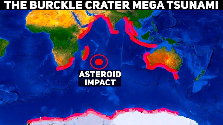
The video above is about megatsunamis that occurred in my estimation about 2,300 BC due to late asteroid impacts. The rest of this paper is about megatsunamis of the Great Flood, which I estimate occurred c. 3,300 BC.
In this post https://cataclysmicearthhistory.substack.com/p/1 I explained that sedimentary rock strata are evidence of a Great Flood about 5,000 years ago.
The following are excerpts from a paper on the Great Flood. My notes are in brackets, like this [].
NOAH’S FLOOD: THE KEY TO CORRECT INTERPRETATION OF EARTH HISTORY
https://www.socalsem.edu/noahs-flood-the-key-to-correct-interpretation-of-earth-history
[LARGE TIDAL PULSES WERE REQUIRED.]
Global-scale numerical modeling of Flood erosion and sedimentation
In the context of the global Flood described in the Torah, what could possibly have been the mechanism that resulted in such a large-scale pattern of erosion and sedimentation? Recently Baumgardner (2013) has developed a numerical model designed to explore this issue. The numerical approach applies the equations of open channel turbulent flow to model sediment transport and deposition within the framework of a scheme that solves the shallow water equations on a rotating sphere. The treatment of erosion is restricted to cavitation. Up to this point the continental geometry has been restricted to a single circular supercontinent that covers 38% of the spherical surface. Numerical experiments so far suggest that large tidal pulses are required to drive the water strongly enough to erode, transport, and deposit the required volumes of sediment.
[TIDAL PULSES WERE OVER A MILE HIGH ON LOWLAND.]
Figure 13 contains snapshots of the solution from this model at a time of only one day after the onset of a tidal pulse of amplitude 2500 m centered at 30° latitude and 90° longitude relative to the center of the continent. The circular continent initially is slightly domed, with a height of 150 m above sea level at its center and 24 m below sea level about its perimeter. The surrounding ocean has a uniform depth of 4000 m.
Figure 13. Snapshots at time of one day after the onset of a 2500 m high tidal pulse of (a.) suspended sediment load, (b.) cumulative bedrock erosion, (c.) net cumulative sedimentation, and (d.) topographic height relative to sea level in a global erosion/sedimentation model.
[FLOOD MAP SHOWS MAXIMUM FLOOD VELOCITY 242 M/S OR 541 MPH.]
https://www.socalsem.edu/wp-content/uploads/2015/08/flood16.png
The velocities indicated are the velocities near the top of the moving water layer. The vertical water velocity profile decreases to zero in a logarithmic manner at the land surface according to standard turbulence theory. Cavitation erosion of crystalline bedrock is assumed to produce sediment that is 70% fine sand with a mean grain size of 0.063 mm, 20% medium sand with a mean grain size of 0.50 mm, and 10% coarse sand with a mean grain size of 1.0 mm. A modest amount of isostatic compensation is folded into the topography calculation. Bottom friction and turbulent eddy viscosity are included in the momentum equation and cause the water velocities to diminish with time. Nevertheless, moderate erosion and sedimentation continues for several weeks after the tidal pulse. A significant amount of erosion occurs at the continent margin.
[SIX TIDAL PULSES OVER 150 DAYS.]
The experiments conducted thus far indicate that six such pulses spaced about 30 days apart are adequate to erode, transport, and deposit, on average, the 1,800 m of sediment observed to blanket the continental surface today. The strong, global-scale tsunami-like waves these pulses initially generate do indeed result in erosional unconformities that affect most of the continent surface.
HIGHLIGHTS
1. The Flood occurred when the land was all part of one large supercontinent that was all under 150 meters or 450+ feet in elevation. So there were not yet any mountains. So mile high tidal pulses were sufficient to flood the entire supercontinent.
2. High velocity flood waters cavitated rocks and sand from the supercontinental shelf and carried it across the supercontinent, depositing it along the way. 500 mph water occurred only in a few locations. Most averaged 200 to 400 mph.
3. There were 6 tidal pulses in all, which were each about a month apart. What caused these tidal surges? The Moon now orbits the Earth in about 30 days. Presently, the Moon only raises tides a few feet high in mid-ocean. In order to raise tides a mile or more high, it must have been on an elliptical orbit and its closest approach, called perigee, must have been much closer than now, maybe 50,000 miles, compared to over 200,000 miles now. Its apogee would have been farther away than now. It’s possible that some other body was orbiting Earth, but the Moon is the best candidate.
4. In the previous section on Earth and Moon Impacts, it was noted that the Earth was likely struck by over 40,000 meteors during the Great Flood. Most of those would not have left craters (like those on the Moon etc) because of hitting ocean waters. The forty days of rain at the start of the Flood was likely caused by such impacts.